Climate
Search

Main navigation

  • Climate 101
    • What We Know
    • What Can Be Done
    • Climate Primer
  • Explore
    • Podcast
    • Explainers
    • Climate Questions
    • For Educators
  • MIT Action
    • News
    • Events
    • Resources
  • Search
MIT

Main navigation

  • Climate 101
    • What We Know
    • What Can Be Done
    • Climate Primer
  • Explore
    • Podcast
    • Explainers
    • Climate Questions
    • For Educators
  • MIT Action
    • News
    • Events
    • Resources
  • Search
PostMarch 1, 2017

Comparing the green canopy of urban spaces


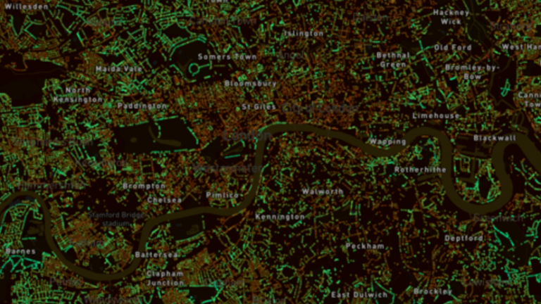
Are you interested in how your city ranks for green space? MIT’s Senseable City Lab have developed a new platform which allows you compare the canopy cover of different cities, countries, and continents across the world. Treepedia uses Google Street View to generate a Green View Index (GVI) for each location, measuring tree canopy coverage to generate an interactive map of the area. 

Tree canopy coverage is an important factor in reducing urban temperatures, by blocking short-wave radiation and alleviating air pollution caused by everyday urban activities. See how your city compares and learn more about Treepedia here. 
by ClimateX Team
Topics
Buildings
Cities & Planning
Climate Modeling
Forests

Related Posts

PostAugust 4, 2026

Reframing leadership as a design problem

MIT News
Nicholas de Monchaux is Weber-Shaughness Professor of Architecture at MIT, as well as professor of urban studies and planning and affiliated faculty with the Program in Science, Technology, and Society.
PostJuly 16, 2026

For energy systems that power a reliable grid, the future is all about loca...

MIT News
MIT researchers have created a way to make more climate-informed energy siting choices and shown how it can be used to make energy systems more resilient and reduce blackouts.
PostJuly 15, 2026

3D-printed bridge points the way to greener construction

MIT Civil and Environmental Engineering
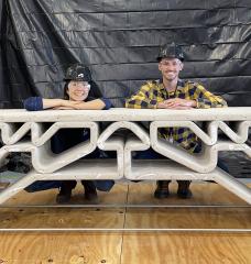
MIT Department of Civil and Environmental Engineering postdoc Hajin Kim-Tackowiak (left) and graduate student Zane Schemmer pose with the 3D-printed concrete bridge they designed and load-tested.
PostJuly 1, 2026

Advancing a scenario-based modeling framework for long-term land-use planni...

MIT Center for Sustainability Science and Strategy
Mississippi River watershed

MIT Climate Knowledge in Your Inbox


MIT Groups Log In

Log In

Footer

  • About
  • Terms & Conditions
  • Privacy Policy
  • Accessibility
  • Contact
MIT Climate Project
MIT
  • Instagram
  • TikTok
  • YouTube
  • Simplecast
Communicator Award Winner