Have a question?

Is it true that wind turbines don’t work in the winter?

No: with proper preparation, wind turbines can work in extreme cold temperatures and in snow and ice.


Updated January 8, 2024

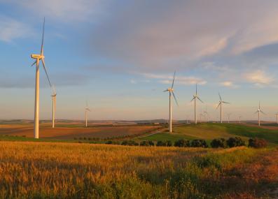
Wind projects are generating electricity today in a wide variety of locations and environments, including cold climates like Finland and Sweden and extreme environments like the cold waters of the North Sea. Wind turbines in these environments are outfitted to cope with snow, ice, and extreme cold. International design standards actually require that wind turbines can work at temperatures down to -4° Fahrenheit. Turbines engineered for cold climates—using technologies like cold-resistant steel and heaters to warm them—can work at temperatures down to -22° Fahrenheit.1
 
In the United States, data from 2001 to 2013 shows that the performance of wind farms during winter months is about average.2 Even when it’s cold, output continues to be high in regions where winter means snow and frigid temperatures, including New England and the Midwest.3

But ice can be a problem for turbines that are not prepared to operate in icy conditions. During Texas’ record cold weather in 2021, which took electric systems down and led to the deaths of at least 246 people,4 some wind farms stopped producing electricity because some turbines iced over or were not designed to operate in such cold temperatures, which can make equipment brittle.1 But that was a flaw in preparation, not in wind power itself. Indeed, Texas saw a much bigger shortfall in natural gas—which supplies most of the state’s electricity5—than in wind energy during that freeze, because the state’s natural gas infrastructure, too, had not been weatherized for extreme cold.6

“The primary issue with the wind turbines in Texas is that such extreme cold weather was not expected based on the historical record of weather, and therefore the developers did not weatherize the wind turbines,” says Michael Howland, MIT professor of civil and environmental engineering. “Wind turbines operate in much colder locations than Texas, and dealing with icing is very straightforward and common through weatherization.”

When extreme weather happens in places where turbines are not outfitted with weatherizing technologies like water-resistant coatings or heaters to repel and melt ice, wind energy production can suffer. Engineers continue to experiment with the best materials and heating mechanisms to ensure that cold-weather turbine equipment functions at its most efficient, but the global installation of more than 900 gigawatts of wind7—including a few turbines operating in Antarctica—indicates that turbines can absolutely continue working in cold and wet weather.

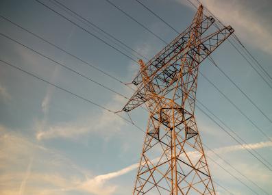
Reliable wind energy also depends on the resilience of other electric infrastructure, like power lines, to extreme cold. Even if a turbine is able to produce electricity at low temperatures, it needs to be able to transport that electricity to function properly. Transmission and distribution lines, which carry electricity from where it’s produced to where it’s consumed, can get iced over or torn down in storms. Building an overall more resilient electric grid will help prevent outages and blackouts as climate change advances and causes more extreme weather.

“Since extreme weather is increasingly affected by climate change, we may need to revisit which locations require wind turbine weatherization,” says Howland.


Thank you to Julie Grant of Rowland Heights, California, for the question. You can submit your own question to Ask MIT Climate here.

Read more Ask MIT Climate


Creative Commons Attribution-NonCommercial-ShareAlike 4.0 International license (CC BY-NC-SA 4.0).
Footnotes

1 National Renewable Energy Laboratory: "Examination of the Extreme Cold Weather Event Affecting the Power System in Texas - February 2021."

2 U.S. Energy Information Administration: "Wind generation seasonal patterns vary across the United States," February 25, 2015.

3 U.S. Energy Information Administration: "U.S. wind generation falls into regional patterns by season," November 30, 2022.

4 Texas Department of State Health Services: "February 2021 Winter Storm-Related Deaths - Texas," December 31, 2021.

5 Texas Comptroller: "Texas’ Electricity Resources," Lisa Minton, August 2020.

6 Electric Reliability Council of Texas: "Update to April 6, 2021 Preliminary Report on Causes of Generator Outages and Derates During the February 2021 Extreme Cold Weather Event," April 27, 2021. For a readable summary of these findings, see, "Texas largely relies on natural gas for power. It wasn’t ready for the extreme cold," Erin Douglas, Texas Tribune, February 16, 2021.

7 Global Wind Energy Council: "Global Wind Report 2023."

Want to learn more?

Listen to this episode of MIT's "Today I Learned: Climate" podcast on extreme winter weather.

Transcriptions

[00:00:00] CBS clip: …For the first time in Texas, all 254 counties are under a winter storm warning. The temperature in Dallas is already colder than in Anchorage, Alaska.

[00:00:14] LHF: In February 2021, Texas had a winter storm that hit the state hard.

[00:00:20] CNN clip: … we know about 4 million customers also without power. More than 3 million of which across the lone star state.

[00:00:27] LHF: Here in the U.S., winters are warming faster than any other season. But then, why are some winter storms getting even more intense?

Could climate change be making some of our winter storms… worse?

I’m your host, Laur Hesse Fisher of the MIT Environmental Solutions Initiative. And this is, Today I Learned: Climate.

Today, my guest is going to help us understand the connection between climate change and extreme winter weather.

[00:00:59] JF: My name is Jennifer Francis. I'm a senior scientist at the Woodwell Climate Research Center in Falmouth, Massachusetts, and I'm an atmospheric scientist, so I've been mainly focused on the atmosphere in the Arctic.

[00:01:13] LHF: Dr. Francis told us that to understand what’s happening with winters in the US, we need to first understand what’s happening in the Arctic.

The Arctic is the northernmost part of our planet – a region of land, sea ice and ocean that surrounds the north pole at the top of North America, Scandinavia and Russia – and it’s ground zero for global warming.

[00:01:38] JF: The Arctic is warming about four times faster than the globe as a whole. And that is having all kinds of impacts on the ice up there.

[00:01:49] LHF: Especially sea ice: the Arctic is about 60% ocean, much of which is frozen over.

[00:01:57] JF: Sea ice, it actually forms from sea water. So it freezes up during the fall and winter, it gets thicker and thicker, and then when that ice starts to melt, it exposes more of the underlying ocean.

And so instead of having this reflective white surface that sends most of the sun's energy that hits it right back to outer space. When we have less of that ice, that sun's energy instead goes into the ocean and warms it up, which melts even more ice. And so that exposes even more of the dark surface. And so we get this vicious cycle.

And all that extra energy that's going into the Arctic ocean, where that ice used to be, is the main contributor to the fact that the Arctic is warming so much faster. It's been estimated that global warming is 25% to 40% larger than it would be if we didn't have these Arctic bright surfaces disappearing.

[00:02:56] LHF: Wow, hold up, let’s repeat that.

[00:03:00] JF: It's been estimated that global warming is 25% to 40% larger than it would be if we didn't have these Arctic bright surfaces disappearing.

[00:03:11] LHF: That’s an incredible impact. This warming has big consequences in the Arctic—from roads sinking because they were built on permafrost, to polar bears drowning, to lost ways of life like traditional hunting on the sea ice.

But the Arctic warming can also make the weather further south kind of… wacky. And to understand why, we need to quickly learn about…the jet stream.

There are four main jet streams on Earth. We’re going to focus on the northernmost one, which flows over North America and Eurasia a little south of the Arctic.

[00:03:46] JF: The jet stream is this fast moving river of wind high over our heads. The winds blow from west to east. The reason it's called a jet stream is because it exists up where jets tend to fly.

[00:04:01] LHF: Yeah, the jet stream can blow at more than 100 miles per hour so pilots actually try to fly in the jet stream to get a little boost – that’s why your flight going from, say, San Francisco to Boston will be shorter than the return flight east to west.

These rapid winds form because the cold air of the Arctic is meeting the warm air closer to the equator.

[00:04:25] JF: Warm air takes up more space. So if you can think about a layer of the atmosphere that extends from say, the middle of the United States up to the Arctic, it's going to be a taller thicker layer in the south. And then as you go north, where it gets colder, that layer shrinks because air shrinks as it gets colder.

So if you can imagine sitting up on top of this layer, looking northward, it would look like you're looking down a hill, which in fact you would be, and the air on top of that layer wants to flow down that hill, just like water wants to flow down the side of a mountain.

[00:05:02] LHF: And as the air is falling downhill – north – it’s also being pulled to the east by the rotation of the planet. This creates the jet stream.

It sometimes curves north and south. It might, say, dip from Idaho down south to Kansas, and then maybe go back up north around Maine.

But lately, the jet stream has been changing.

[00:05:26] JF: Because the Arctic is warming so much faster, we're seeing that north-south temperature difference get smaller. And because it's smaller now, a lot smaller than it used to be, we're seeing the winds of the jet stream actually get weaker.

[00:05:42] LHF: The “hill” is less steep, so the air doesn’t flow down it as quickly.

[00:05:48] JF: And when the jet stream winds get weaker, it tends to get deflected more to the north and south. That allows the cold air to penetrate much farther south. And those big waves in the jet stream also tend to move much more slowly from west to east. So the result is, sort of the bottom line of all this is, that the weather patterns that we experience feel like they're getting stuck in place.

[00:06:15] LHF: And that’s how the ice melting in the Arctic can make cold spells last much longer and go much further south.

Now we’ve gotten this far without talking about something you’ve probably heard about in the news: the polar vortex.

[00:06:32] JF: I think the polar vortex has gained so much traction because it sounds scary and horrible.You think of a vortex being something that's gonna suck people in and they're gonna disappear forever.

[00:06:45] LHF: But the polar vortex is a normal, natural thing. Just like the jet stream, it’s a river of fast-moving air.

[00:06:52] JF: But it's much higher in the atmosphere than the jet stream is. And it's much farther north. It sits up over the north pole.

[00:07:01] LHF: Every couple of years or so, the polar vortex stretches out, or even splits into two or three separate swirls. This can nudge arctic air into the jet stream and push it farther south.

[00:07:14] JF: This is actually exactly what happened during the Texas cold spell of February, 2021. We had one of these pieces of the polar vortex that drifted down over the middle of North America.

[00:07:26] LHF: That natural event was paired with a slower, weaker jet stream.

[00:07:31] JF: And it made that cold spell more severe, longer lasting, and it made it dip even farther south than a normal cold spell would.

Dallas was minus two degrees Fahrenheit.

[00:07:43] LHF: In that 2021 storm, millions of homes lost power because the state’s energy instructure couldn’t keep up with the cold—just when people needed that power most to keep warm.

OK, let’s switch gears for a moment and talk about that other staple of winter weather: snow. A warmer planet means less snow, right?

[00:08:06] JF: In places where snow is kind of marginal, like right along the east coast of New England, we're going to see more rain because it's just warming that much more.

[00:08:17] LHF: Right, this is straight-forward: in some places, even a few degrees can make the difference between snow and rain.

[00:08:24] JF: But the opposing factor is that as the oceans warm and as the atmosphere warms, evaporation from the oceans and the land increases. And so that puts more water vapor into the atmosphere. So when you do get a snowstorm, there's more water for the storm to work with. And so we're seeing, the possibility anyway, of getting heavier dumps of snow in places where it's cold enough.

[00:08:50] LHF: So places that have very cold winters like the upper Midwest, or much of Canada and far northern EurAsia, might see more snow as the climate warms. And even places with milder winters are seeing larger individual snowstorms, even as they get less snow on average over the year.

So even though, on average, winters really are getting milder, a warmer planet can cause storms that are longer, colder and snowier.

And this is in keeping with other impacts of climate change. Things are a little warmer, yes—but what we notice most is that it’s more extreme.

[00:09:30] JF: It was an incredible winter back in 2021 with that amazing cold spell, it wasn't just in the center of North America. At the same time they were having an extremely devastating cold spell in Eurasia. These extreme events never happen in isolation. And that's because when the jet stream gets into the one of these very wavy patterns, it's not just in one place. It tends to be around the whole Northern hemisphere.

[00:10:04] LHF: That’s our show for today. As always, you can check out our shownotes to dig deeper into what we covered in the episode. This episode’s Educator Guide explores the jet stream and polar vortex, and allows students to get hands-on with the albedo effect. You can find both at tilclimate.mit.edu.

TILclimate is produced by the MIT Environmental Solutions Initiative at the Massachusetts Institute of Technology. David Lishansky is our Editor and Producer. Aaron Krol is our Associate Producer — and did our artwork. Natalie Jones was a scriptwriter for the episode. Michelle Harris is our fact-checker. Sylvia Scharf is our Climate Education Specialist. Adam Nacov is our student production assistant. The music is by Blue Dot Sessions. And I’m your Host and Producer, Laur Hesse Fisher.

Thank you to Dr. Jennifer Francis for speaking with us, and thank you for listening.