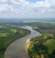
The Congo River is the world’s second-largest river system after the Amazon. More than 75 million people depend on it for food and water, as do thousands of species of plants and animals that live in the swamps and peatlands it supports. The massive tropical rainforest sprawled across its middle helps regulate the entire Earth’s climate system. The amount of water in the system, however, is something of a mystery.
Hydrologists and climate scientists rely on monitoring stations to track the river and its connected water bodies as they flow and pool across six countries, and to measure precipitation. But what was once a network of some 400 stations has dwindled to just 15, making it difficult to know exactly how climate change is affecting one of Africa’s most important river basins.
“To take action, to manage water, we need to know about our water resources,” says Benjamin Kitambo, a geologist with the Congo Basin Water Resources Research Center in Kinshasa, Democratic Republic of the Congo. “But we can’t know something that we don’t measure.”
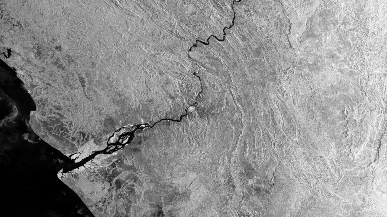
Researchers around the world are increasingly filling data gaps on the ground using information gathered from space. Satellites equipped with remote sensing instruments can peer into places where “in situ” measurements—those taken on site—are outdated, hard to gather, or kept private.
Kitambo spoke by video call from Toulouse, France, where he’s conducting PhD research at the Laboratory of Space Geophysical and Oceanographic Studies. These days, he’s analyzing troves of satellite measurements and hydrological models to understand how the Congo River’s tributaries, wetlands, lakes, and reservoirs are changing. That includes studying records from more than 2,300 “virtual” gauging stations, which estimate two key metrics throughout the basin: “surface water height,” or the water’s level above a reference point, and surface water extent.
He says most of the region’s field data dates back to before 1960, the year most countries in the region gained independence from European colonizers. Since then, research there has sharply declined, and collecting data on surface water has proved difficult.
About five years ago, the Congo Basin research center began installing a network of water-monitoring stations to address the “severe lack of basic knowledge” about the river’s main navigable channels, which often serve as roads. But some places in the vast basin were too remote or rugged for researchers to reach. In others, people removed the newly installed instruments to sell the materials, or because they feared being spied on.
Read the full article here: https://www.technologyreview.com/2021/12/22/1041323/remote-sensing-freshwater-climate-hydrologist/