Monday, November 5, 2018
Studies show cloud variability during El Niño events could help better predict long-term climate change.
Story originally written for the EAPS Program in Atmospheres, Oceans and Climate (PAOC).
How clouds, which both shield and trap heat from Earth, respond to global warming is generally regarded as the major source of uncertainty in climate projections. But even after decades of research, climate scientists still haven’t made much progress on this question, motivating them to look for new ways of predicting how clouds will respond to climate change.
This has become an area of interest for Nick Lutsko, a postdoctoral associate in the Cronin Group within MIT's Department of Earth, Atmospheric and Planetary Sciences (EAPS), whose recent research uses naturally-occurring variations in Earth’s climate to predict how it will warm in the future. In other words, how we can use short-term cloud changes to better predict long-term climate change.
In two published papers this Fall, Lutsko outlined how cloud changes during El Niño–Southern Oscillation (ENSO) events can help us better understand Earth's climate sensitivity to a doubling of atmospheric CO2, also called equilibrium climate sensitivity.

In the first article, titled “What Can the Internal Variability of CMIP5 Models Tell Us about Their Climate Sensitivity?” and published in the American Meteorological Society’s Journal of Climate, Lutsko found that cloud changes on ENSO time scales (2 to 5 years) are closely related to climate models’ equilibrium climate sensitivities.
The findings imply that cloud variability during ENSO can help predict how surface temperatures will respond to long-term changes, like CO2 increases. This concept is called an “emergent constraint,” which is when something we can observe today (cloud variability) can be used to predict how the climate will change in the future (because of increased CO2 concentrations).
“People were actually surprised by this because El Niño events have different spatial patterns than global warming,” said Lutsko. “But during an El Niño event, you’re changing the sea surface temperatures in the East Pacific and that’s causing clouds to change there, and it turns out those changes are related to how clouds will change under global warming.”
There’s just one caveat. To actually use the emergent constraint, Lutsko found, we would need at least 100 years of observational data. “And really optimistically speaking we have 30 years of data, so that’s kind of disappointing,” he said. “What you would like it to say is that you could make measurements for 5 years and know everything. But it turns out you need a lot of data for these things to start working.”
Data limitations aside, if understanding how clouds behave during ENSO events can help us predict how much the Earth will warm up due to increased CO2 concentrations, where would we look next? What kind of clouds actually matter?
It turns out not all of them. In a subsequent paper, titled “The Relationship Between Cloud Radiative Effect and Surface Temperature Variability at El Niño‐Southern Oscillation Frequencies in CMIP5 Models,” published in Geophysical Research Letters, Lutsko investigated the behavior of different cloud types during ENSO events in climate models to see which types played the largest role.
He found that, in the models, high clouds play only a minor role in ENSO‐induced surface temperature anomalies. The main players are actually low clouds, like marine stratocumulus. These clouds are responsible for the strong correlations between cloud variability and models’ long-term warming. This, says Lutsko, shows that better understanding changes in tropical low clouds during ENSO events also allows us to better understand how clouds behave in a warmer world, regardless of the emergent constraint.
“So it’s not even that you need to know how all clouds change during ENSO events, just low clouds” said Lutsko. “And that tells you something about how they’ll change as Earth warms up.”
The results provide further impetus for scientists to study how clouds evolve during ENSO events, Lutsko hopes, since more data on clouds will not only help researchers understand El Niño, one of the most important naturally-occurring weather events, but also some of the most pressing puzzles regarding climate change.
“Even though you need 100 years of data, if we can better understand the physics of how clouds behave during ENSO better, we can turn around and use that to better understand how it will change under global warming,” said Lutsko.
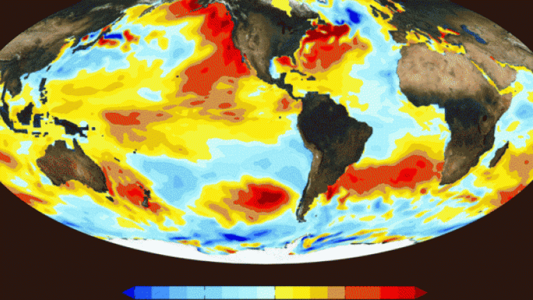
Story Image: Sea surface temperature patterns of the 2015 El Niño in the Pacific Ocean. El Niño is a quasi-decadal warming of the central and eastern Pacific Ocean that affects weather patterns all over the globe. (Credit: NASA)