

A perspective by MIT CS3 Principal Research Scientists Angelo Gurgel and Jennifer Morris
This Research Insight highlights the design, development and application of a new, scenario-based modeling framework that projects the future of land use in a geographic region at high resolution.
Science
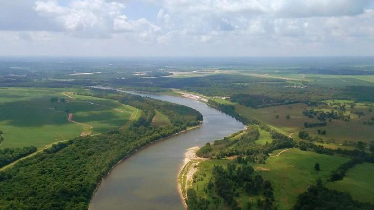
In a recent study co-authored with a team of researchers from the MIT Center for Sustainability Science and Strategy (CS3) and the Pacific Northwest National Laboratory (PNNL), we projected future land use in the Mississippi River basin in the broader context of a changing economy. We focused on factors that would, individually and collectively, put more or less pressure on the ways that we use cropland, pastureland and forests over time, including population growth, economic growth, climate change, crop and livestock yields, changing diets, and international trade. For example, in some parts of the world, a warmer, drier climate could limit land productivity, and higher GDP could result in higher meat consumption. Or higher import tariffs across the world could restrict global trade of food and food products, thereby requiring nations to set aside more land to cultivate crops and livestock domestically. Then we developed two scenarios in which all of these factors combine to either have the lowest or highest possible likely stress on the land, along with 15 additional scenarios in between those extremes. Under the lowest-stress scenario, lower population and economic growth and higher yield growth would result in less stress on the land; under the highest-stress scenario, the level of stress on the land would make it much harder to use that land in ways that could meet societal needs.
Computational tools
To perform this analysis, we used our MIT EPPA (Economic Projection and Policy Analysis) model along with Demeter, a land-use downscaling tool that allowed us to take our projections of how land use will evolve into the future for the 18 world regions designated in EPPA, and obtain high-resolution results for the four sub-basins of the Mississippi River. At each time step of our 17 scenarios between 2020 and 2050, we matched supply and demand for everything in the economy, from food to energy, with the model making land-use decisions based on the highest economic value that could be generated by a given parcel of land, taking into account any land conversion costs and emissions. Under the highest-pressure scenario, more land is needed for agriculture in order to meet demand for food and other land-based products; under the lowest-pressure scenario, less land is needed to meet that demand. So each of our 17 different scenarios have different implications for land use in the Mississippi River basin.
Strategy
The value of this study for decision-makers is twofold. First, they can look for favorable land-use choices that are more or less robust across the different scenarios. That's very useful information, because it suggests that those choices are probably smart uses of land in all different types of future potential conditions. Second, they can look for any big changes that are projected to occur across the scenarios. By identifying land-use choices that result in very different outcomes in a low-pressure versus high-pressure world, they can better understand the level of risk that specific land-use decisions might entail. This helps clarify what type of land uses one might need to think more carefully about or avoid entirely, because they might not be good choices in any potential future. For example, in one of the Mississippi River sub-basins that historically has been a major corn producer, all 17 scenarios indicate that the most economical use of this land would be for livestock pasture. This kind of analysis could help local decision-makers identify such opportunities, which may or may not face pushback from vested interests. Since publishing this study, we have developed our land-use modeling framework to produce high-resolution land-use projections for other regions across the globe.
MIT CS3 Principal Research Scientist Angelo Gurgel’s research focuses on understanding the interactions of natural resources, technological constraints and human systems with the goal of identifying sustainable future development pathways. He conducts socio-economic-environmental modeling and applied research on climate change, land-use changes, climate policy, bioenergy, climate change mitigation technologies, and agricultural and environmental economics.
MIT CS3 Principal Research Scientist Jennifer Morris’s research focuses on energy-economic modeling and linkages between human and natural systems to explore multi-sector feedbacks and implications of different development, decarbonization and investment pathways. She also focuses on uncertainty, risk analysis, and decision-making in energy and environmental systems.

![The “New World of Weather” project, one of MIT’s five Climate Grand Challenges announced in 2022, is “advancing the science, technologies, and practical strategies needed to help communities anticipate [extreme weather] and build greater resilience,” says MIT Vice President for Energy and Climate Evelyn Wang.](/sites/default/files/styles/teaser_mini_image/public/post-images/mit-climate-cyclone.jpg?itok=KwBU2suI)