New to Climate Change?
The Polar Jet Stream and Polar Vortex
The polar jet stream and polar vortex are two rings of fast-moving air around the Arctic, which play a large role in world weather patterns. Many climate scientists believe that global warming is changing these rings, in ways that allow freezing air from the Arctic to intrude on the warmer mid-latitude regions. This means that, even as the Earth warms on average, climate change may lead some places to see more extreme cold spells during winter.
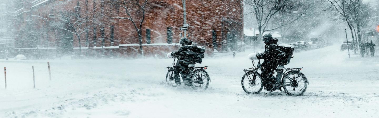
These more frequent extreme weather events pose challenges to protect people and infrastructure from freezing.
The polar jet stream
The polar jet stream sits in the troposphere, the lowest layer of our atmosphere where most weather happens. It is characterized by a belt of wind that blows from west to east at speeds up to a couple of hundred miles per hour. While it shifts a bit north or south throughout the year, it usually stays between the 50th and 60th parallels: roughly between the Great Lakes and Canada’s northern territories, or between France and Norway.1 The jet stream forms at the boundary where cold polar air and warm mid-latitude air try to mix, creating fast-moving waves and eddies.
Thanks to the rotation of the Earth, these eddies don’t just move north and south, but bend in a bow-like shape to the east. The result is a strong system of eastward air currents, keeping cold air confined to the north. And the larger the temperature difference between the Arctic and mid-latitudes, the stronger the jet stream is—which is why it is usually fastest in winter, when the Arctic is coldest.
Extreme cold snaps
Climate change affects the jet stream because different parts of the planet are warming at different rates. In particular, the Arctic is warming fastest. This means that, as the Earth warms, the temperature difference between the Arctic and mid-latitudes is getting smaller.
This makes the polar jet stream slower and weaker. That slower jet stream has less eastward momentum and is more likely to bend north and south as it encounters small variations in temperature and pressure.
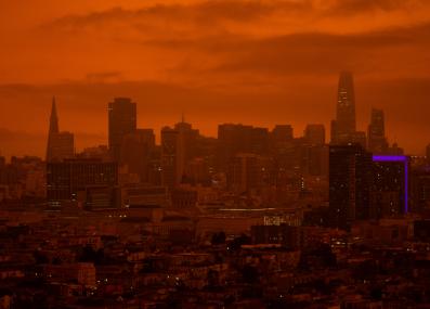
If it bends far enough, the barrier between Arctic and mid-latitude air can plunge as far south as Mexico, bringing Arctic temperatures with it. These wavy jet streams span the Earth, so strange weather may be seen all around the northern hemisphere, with unusually warm temperatures in parts of the Arctic at the same time extreme cold spells reach far south. In February 2021, for instance, Texas endured over a week of freezing temperatures the state was not prepared for, causing power outages and killing hundreds, while much of northern Eurasia also saw extreme cold. And because a weak jet stream moves slowly, these weather conditions can last for days at a stretch.
Click here to see information from the infographic above in a table.
| Image | Description |
|---|---|
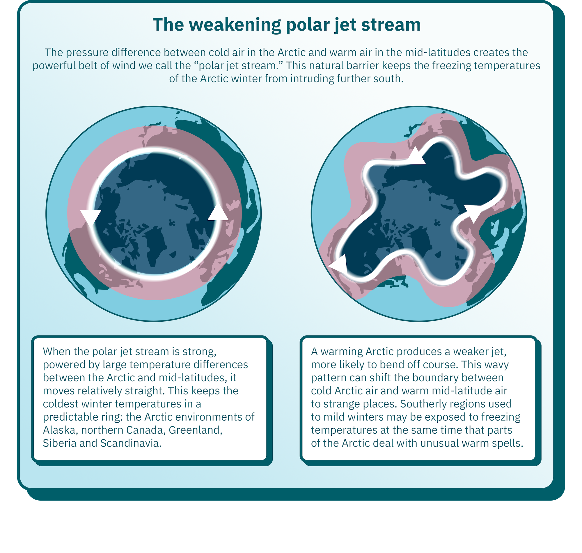
| A circle centered on the North pole, with cold (blue) air inside and warm (red) air outside | When the polar jet stream is strong, powered by large temperature differences between the Arctic and mid-latitudes, it moves relatively straight. This keeps the coldest winter temperatures in a predictable ring: the Arctic environments of Alaska, northern Canada, Greenland, Siberia and Scandinavia. |
| A blob-like shape centered roughly on the North Pole, with cold (blue) air inside and warm (red) air outside | A warming Arctic produces a weaker jet, more likely to bend off course. This wavy pattern can shift the boundary between cold Arctic air and warm mid-latitude air to strange places. Southerly regions used to mild winters may be exposed to freezing temperatures at the same time that parts of the Arctic deal with unusual warm spells. |
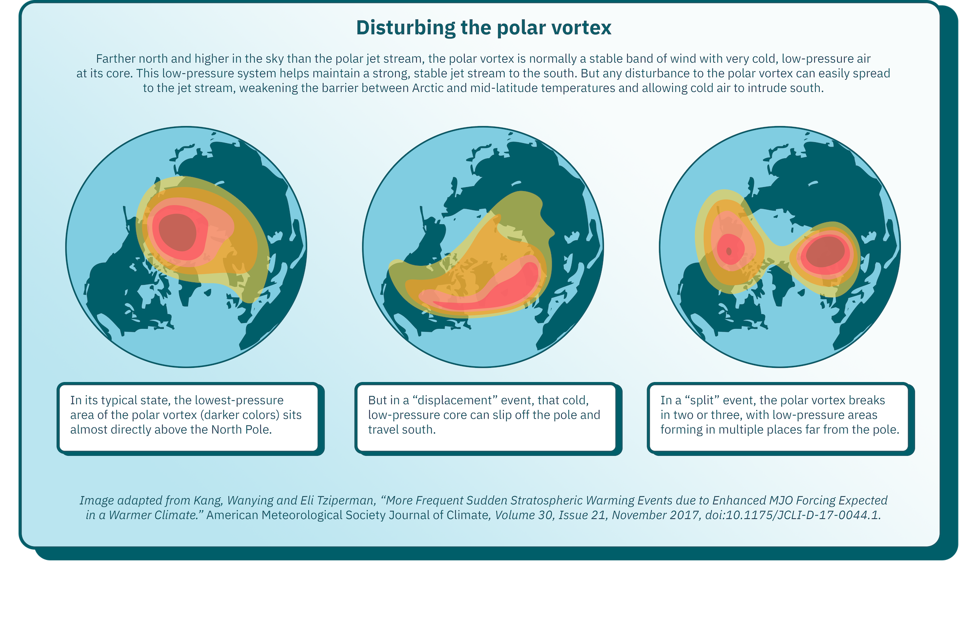
The polar vortex
The polar vortex is higher than the polar jet stream, in the stratosphere up to 30 miles above the Earth. It is also further north, sitting over the North Pole.2 Scientists are still working to fully understand the polar vortex: continuous long-term observations are only available after the satellite era, and many climate models struggle to simulate it. But some climate scientists believe that it, too, is changing in ways that affect weather further south.
Like the polar jet stream, a strong polar vortex helps contain the cold air at its core. Sometimes, natural turbulence from below moves upward to disturb the vortex, and it can break down. This is a natural (but rare) event, which has been happening since long before human-caused climate change, but a warmer Arctic with less predictable weather may make this kind of turbulence more likely.
If the polar vortex is disturbed, it can slip off the North Pole, or even break into two or three separate rings. Either distortion tends to weaken the jet stream to the south.
There have been recent spectacular examples of polar vortex breakdowns leading to extreme winter storms—like an event in January and February 2019 that broke cold temperature records across the eastern U.S. and Canada. But scientists still debate whether climate change will make these events more common in the future.
Click here to see information from the infographic above in a table.
| Status of the polar vortex | Description |
|---|---|
| Typical state | In its typical state, the lowest-pressure area of the polar vortex sits almost directly above the North Pole. |
| Displacement | In a “displacement” event, that cold, low-pressure core can slip off the pole and travel south. |
| Split | In a “split” event, the polar vortex breaks in two or three, with low-pressure areas forming in multiple places far from the pole. |
Published May 21, 2024.
1 There is also a second polar jet stream in the southern hemisphere, circling Antarctica roughly at the southern tip of South America. Both jets are affected by climate change, but the northern polar jet stream has a much greater effect on humanity simply because many more people live in the mid-latitudes of the northern hemisphere.
2 As with the polar jet stream, there are actually two polar vortexes, one on the North and one on the South Pole.


More Resources for Learning
Want to learn more?
Listen to this episode of MIT's "Today I Learned: Climate" podcast about climate change and extreme winter weather.
Keep exploring
With more Explainers from our library: